Storm Alert – Hurricane Debbie
INTERCOT is following the approaching tropical weather, now appearing to be headed for the Gulf of Mexico. According to National Weather Service forecasts and current tracks, “Debbie” is set to cross Florida and potentially exit into the Atlantic and effect the east coast of the US as well.
For current storm information, we highly recommend:
The National Weather Service (the official source)
Mike’s Weather Page (unofficial info, but very up to date pulling details from many sources)
Monday Noon Update
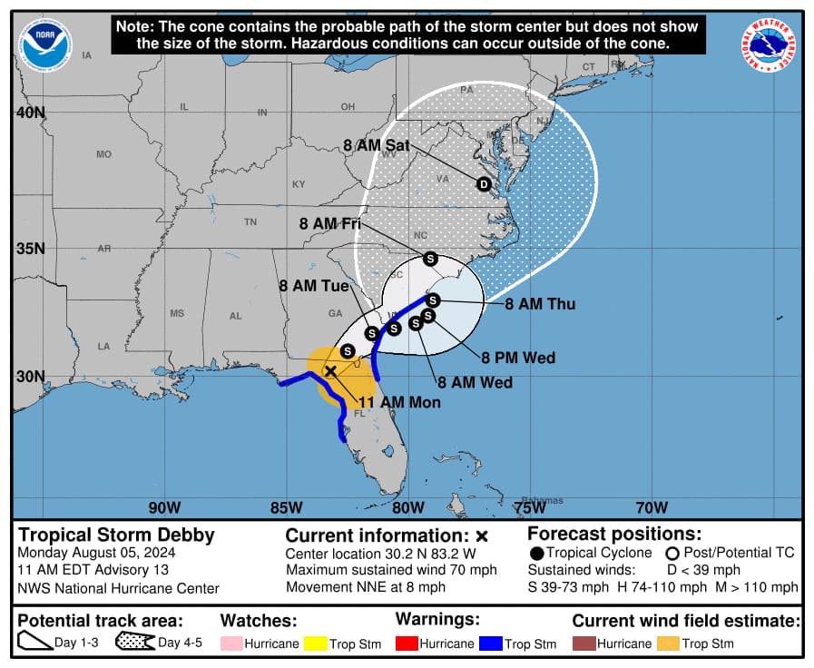
Latest NHC graphic posted to the top of the page. Storm effects across a large part of Florida, Georgia and South Carolina currently. The hurricane is currently in the norther part of the state with heaviest of rain moving away from the Orlando area, but feeder bands of rain still causing issues.
Monday 9am Update
Tornado watches and wind advisory’s in effect throughout the day for the Orlando area. Stay safe everyone and stay tuned to local news and weather.
Sunday 11pm Update
Debby now officially a Hurricane.
Sunday 8pm Update
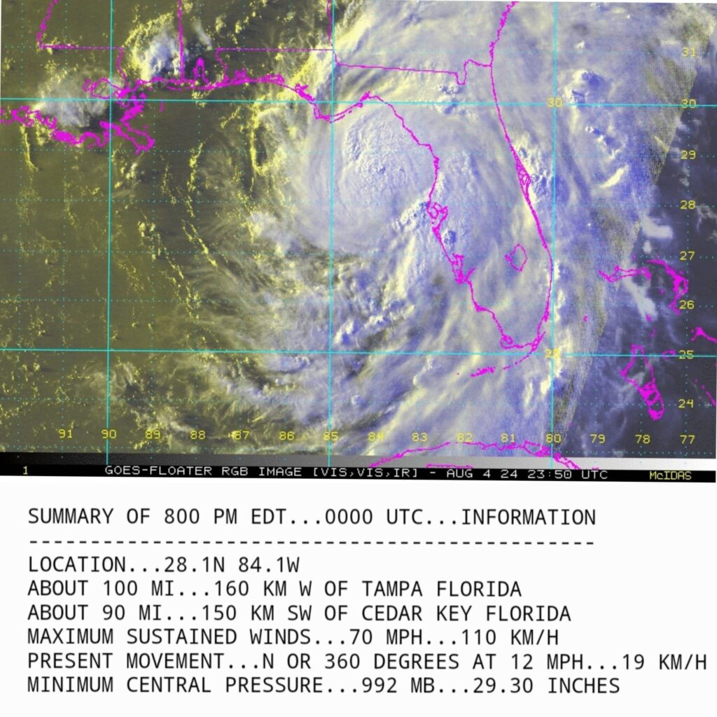
From the National Hurricane Center… Winds up to 70mph. Moving north. www.spaghettimodels.com
Sunday 8:30am Update
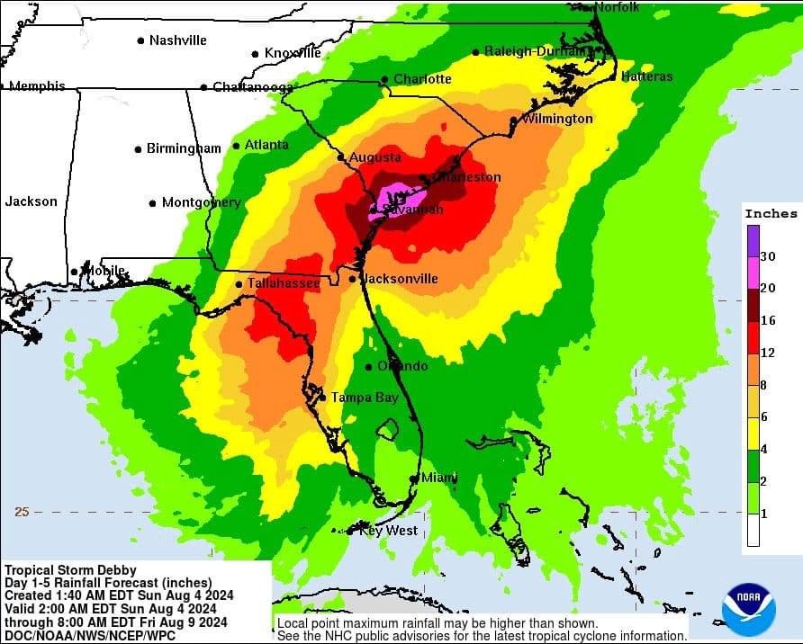
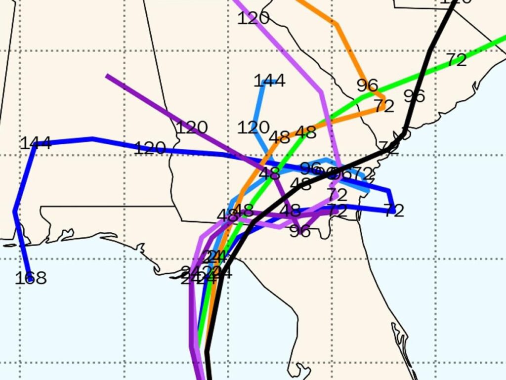
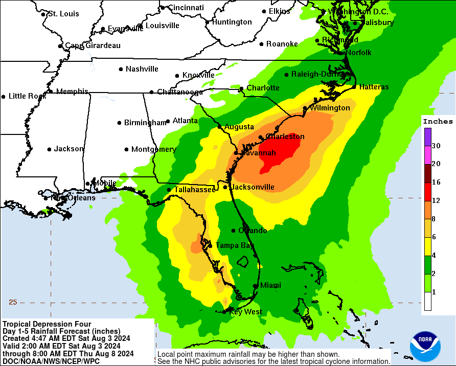
Looking to be an incredibly slow moving storm with big rain totals right now with possible intensification to Hurricane before landfall. Current track updated in the main photo in this post with the predicted rainfall and spaghetti models below.
Saturday 10am Update:
We’ll keep things updated here on the site and have staff on the ground in Orlando to cover the storm as it crosses over the central part of the state.
(Pictured: Potential Rainfall Amounts)




Related Posts
Disney World Expands Historic Ferry Fleet with New Addition
The Electric Mayhem Arrives at Rock ‘n’ Roller Coaster Starring The Muppets
New Rooms and Lobby at Pop Century Resort
Cool KIDS’ SUMMER at Disney World
Josh D’Amaro Named Next Chief Executive Officer of The Walt Disney Company
2026 EPCOT International Flower and Garden Festival: Dates and Details